
[Original (March 7, 2019); Translated by E. Miyazaki/M. Olagoke]
◉Project areas
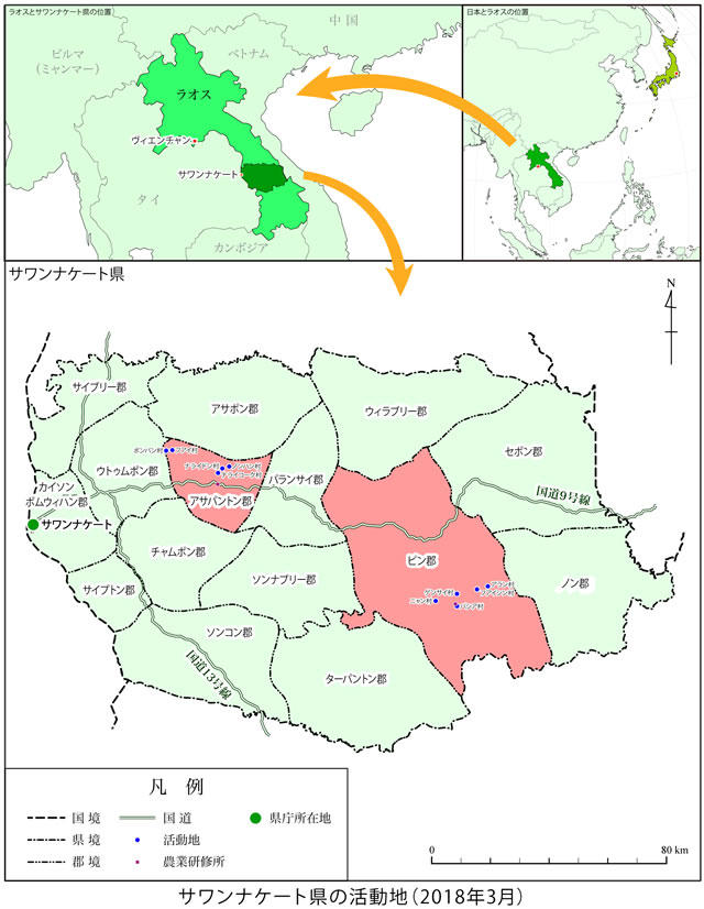
The Savannakhet province is located in the middle south of Laos as indicated by dark green in the upper left map. Our project areas, the Atsaphangthong and Phine districts, are marked by red in the lower map.
JVC will implement projects in two districts in the Savannakhet province which is located in the middle south of Laos. It is adjacent to Vietnam in the east and Thailand in the west and has a population of 940,000 people. This area is experiencing overwhelming development:the Route 9, known as the “East and West Corridors” (a highway), is being built in the center of the province with Japan’s support, and a specific district for economic development has been established along the Mekong River.
In the Atsaphangthong district, rice-paddy cultivation is actively done but plantations are also rapidly developing. Our project areas are located in the northern part of the district along the Xe Champhone River, which is about a two-hour drive by motorcycle from our local office.
The Phine district, on the other hand, is the largest district in the province located in the east. There are lots of mountains and forests left intact. Slash-and-burn agriculture is as popular as rice-paddy cultivation. There are many villages where small ethnic groups live and protect their own languages and cultures. The project area is located in the southern area along the Xe Bang Fai River, and it takes about 5.5 ~ 6.5 hours by motorcycle from the local office. It becomes very difficult to reach there during the rainy season.
◉Problems with the project areas
Plantations are rapidly developing in these areas, which were recently created by the companies of Thailand, Vietnam, and India that got permission from the government. However, despite many of these places being forests or cultivated fields already used by the local residents, most of these lands either are commandeered without compensation or are unjustly being held at low prices.
Most of the residents do not know that there are laws that protect their rights for these lands. Also, they are unable to do anything when their lands are seized with unjustly low amounts of compensation because they do not know how to prove that they have been using their land or evaluate its value by showing biodiversity. The same issue occurs when dams or mines are built. The poor live on natural resources, so it is a pressing issue for them to have their land used fairly.
◉Outline of the project
- We will collect and analyze the fundamental data regarding the management and usage of natural resources in the project areas, develop them into maps if necessary, then create booklets to share with the villagers.
- We will provide training to the villagers and administrators regarding their rights for managing and using natural resources. We will also focus on gender in the trainings, because women’s opinions are seldom taken into account in the management although they play important roles in using natural resources.
- We will establish community forests and fish protection zones based on the data collected and reviewed in item1.
- We will construct a training facility in each of the Atsaphangthong and Phine districts. Based on the data collected and reviewed in item1, we will provide training on agricultural techniques and excavate wells in the villages that need clean water.
- We will encourage the interaction of the villagers in order to spread the achievements of items1 – 4. We will also create a network with government parties, researchers, and other NGOs and communicate the achievements of this project.